|
This blog post discusses about the results of an review I wrote in Finnish Journal of Urban Studies. Earlier blog post's insights into segregation and the change in segregation, are now added with the introducing of well to do high rise areas. As low density areas tend to success in relative measurementd, I was interested in statistically significant combination of urban density and socioecomic status, High density areas with high status cluster mainly in Southern and Western Helsinki (picture 1). Also some new areas like Arabianranta and Viikki differentiate from the average Spatiality of improved dense areas seems cluster in the same areas where the status was already high (Picture 1). However, there are some areas in addition to above mentioned (Picture 2). These areas locate especially in Eastern inner city and inner suburbs. 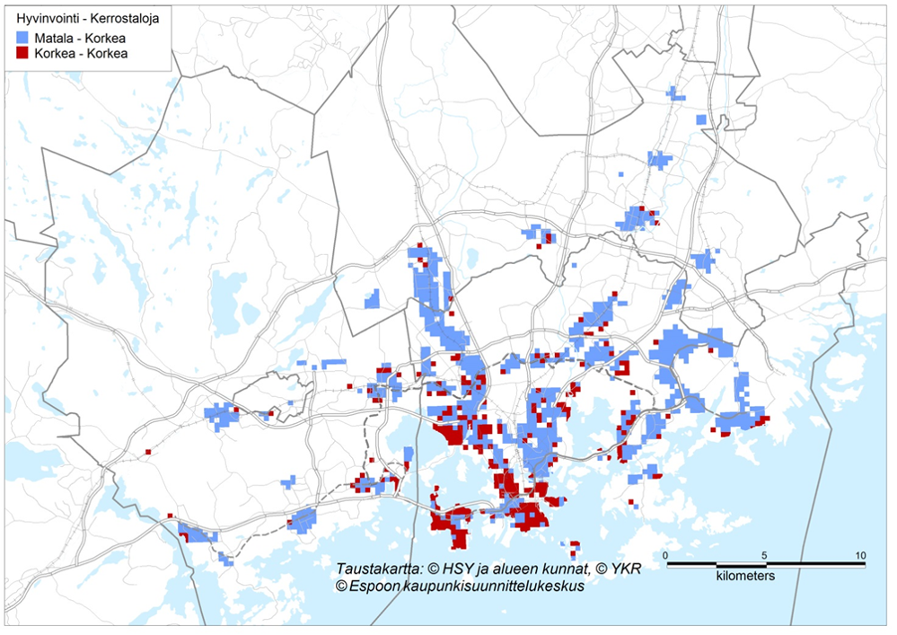 Picture 1. High density areas with high relative economic (red clusters). Picture 2. The change of relative economic status in high density areas. Positive change indicated as red. 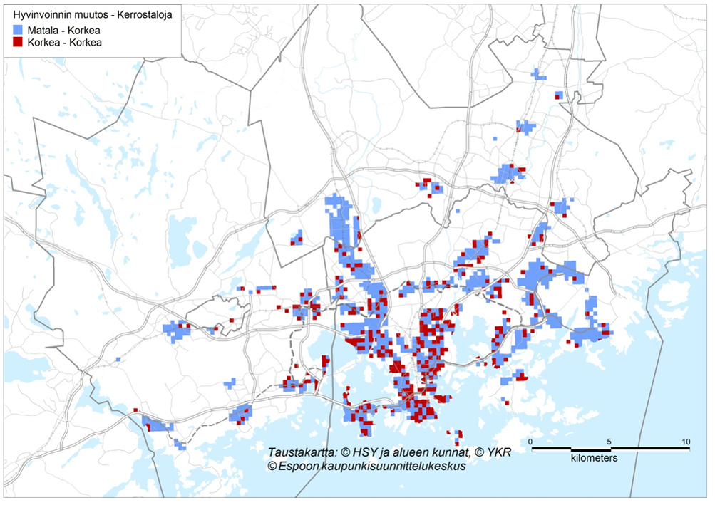
Comments
There has been extensive research of spatial segregation in the HMA (e.g. Vaattovaara 1998, Vilkama 2014). In this study I am going to introduce smaller spatial area unit as well as some new methodology. Study was published in 2015 in Finnish Journal of Urban Studies (link to full text) as an overview. 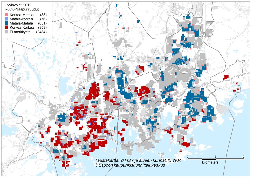 Picture 1. The highest relative socioeconomic status is mainly in western parts of the HMA (municipalities of Espoo and Kaunianen). Lowest status can be founded in Eastern Helsinki and Eastern Vantaa. 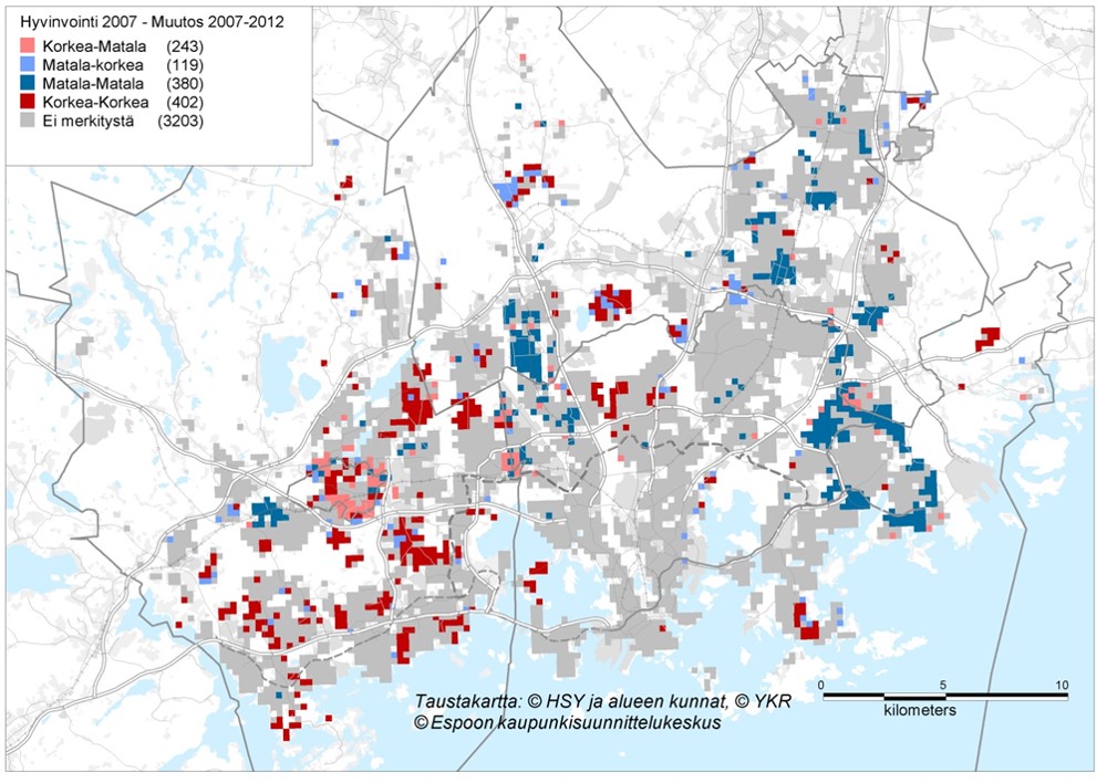 Picture 2. Red cells have increased their relative status even further. Blue parts had low status and have not upgraded since the considered period of time (2007-2012).
|
Photo by Rob Hurson
Categories
All
Archives
July 2018
AuthorJuho Kiuru, geographer living in Helsinki, Finland. |
 RSS Feed
