There has been extensive research of spatial segregation in the HMA (e.g. Vaattovaara 1998, Vilkama 2014). In this study I am going to introduce smaller spatial area unit as well as some new methodology. Study was published in 2015 in Finnish Journal of Urban Studies (link to full text) as an overview. 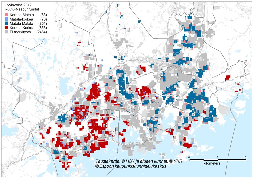 Picture 1. The highest relative socioeconomic status is mainly in western parts of the HMA (municipalities of Espoo and Kaunianen). Lowest status can be founded in Eastern Helsinki and Eastern Vantaa. 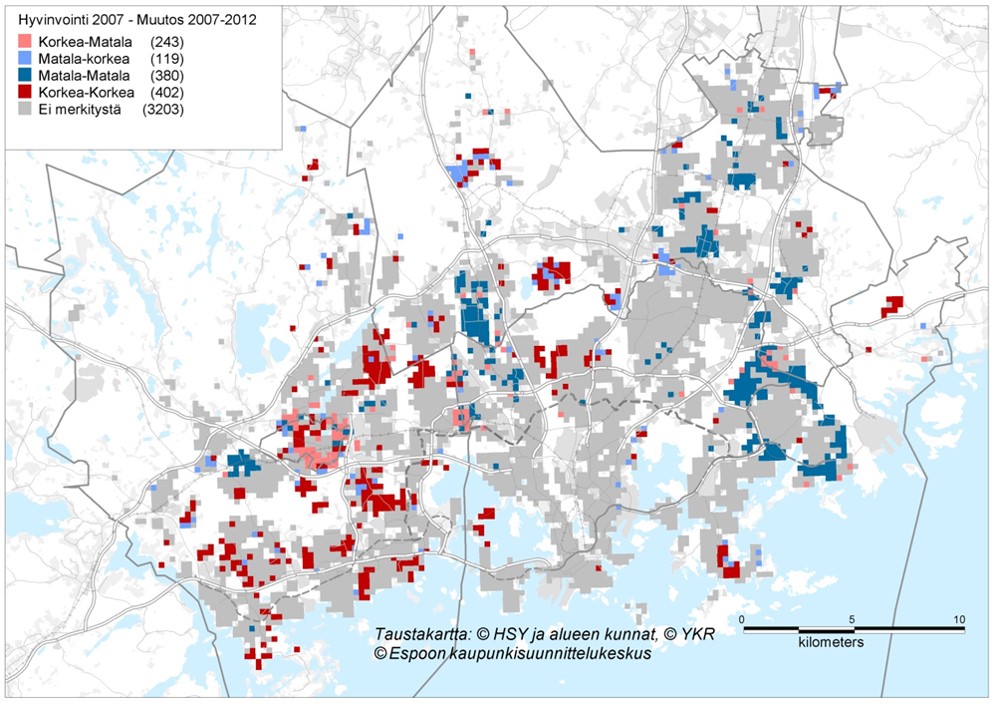 Picture 2. Red cells have increased their relative status even further. Blue parts had low status and have not upgraded since the considered period of time (2007-2012).
Comments
|
Photo by Rob Hurson
Categories
All
Archives
July 2018
AuthorJuho Kiuru, geographer living in Helsinki, Finland. |
 RSS Feed
